Outline Navigation AGV Introduction
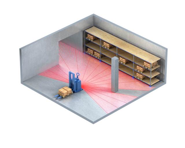
Contour navigation is currently the most advanced navigation technology of AGV. This technology uses 2D laser scanner to measure and learn the scene environment, draw the navigation environment, then how much measurement learning, and modify the map to realize the contour navigation function.
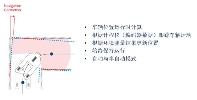
 Free ranging navigation using the natural environment (walls, columns, and other fixed objects) updates the location based on environmental measurements.

Outline navigation principle
Contour navigation turning realization principle

Contour navigation environment measurement implementation
Current contour navigation sensor type:
1. Use a safety laser scanner with measurement function.
2, using a laser scanner with measurement function
Outline navigation sensor installation classification:
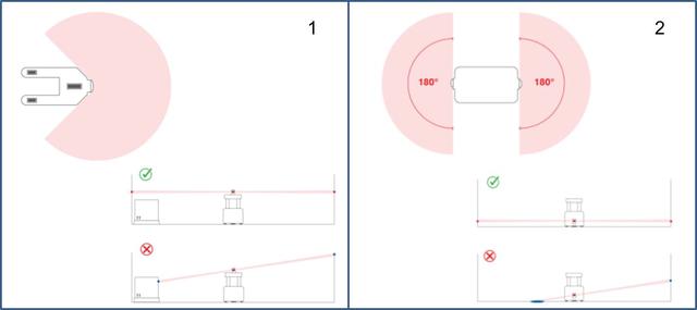
Obtaining a sufficiently large field of view is a necessary condition for contour navigation:
Install a single sensor at a high position to obtain a 270 degree viewing angle.
Install two sensors to achieve a viewing angle of more than 270 degrees. Make sure the levels are aligned.
Contour navigation installation method
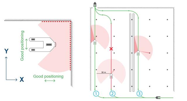
It is important that the goods are placed within the appropriate range (eg a maximum distance of 30 m, 20 m in the feasibility assessment) and on both sides and in front to achieve a complete position update.
Contour navigation AGV path setting
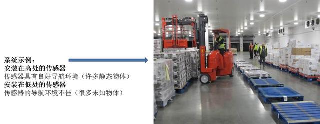
Environmental dynamics
It is acceptable to predict that the sensor's viewing angle will temporarily move due to the movement of employees, vehicles, doors and equipment. Equipment, vehicles, pallets and other solids are more likely to remain stationary while the vehicle is moving.
At least 50% of the sensor readings come from objects in the measured image.
Contour navigation environment dynamic assessment
Outline navigation advantages:
1, no reflector or other artificial landmarks
2, reduce installation costs
3, reduce maintenance work
4, laser navigation alternatives
![[Depth] The rise of Chinese warehousing robot companies](http://www.agvblog.com/wp-content/themes/begin/thumbnail.php?src=http://www.agvblog.com/wp-content/uploads/2020/09/20200904102907-f2f5e.jpeg&w=280&h=210&a=&zc=1)